Hey, Vancouver runners! Did you know that Vancouver’s got the largest 10k road race in Canada? It’s true! It’s called the Vancouver Sun Run.
Running in our city is a breathtaking experience, and we’ve mapped out the ultimate guide. Ready to hit the pavement? Read on for the inside scoop and let’s turn every run into a scenic adventure!
What race is held in Vancouver in October?
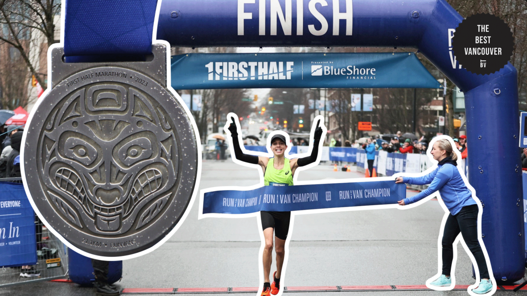
In October, Vancouver hosts the RUNVAN®, co-hosted by Musqueam and the University of British Columbia. The event offers a scenic route around UBC campus, including a Half Marathon, 10KM, and 5KM races for participants of all levels.
Where are the best places to go for a run in Vancouver?
Stanley Park
Website: http://vancouver.ca/parks-recreation-culture/stanley-park.aspx
Address: Vancouver, BC V6G 1Z4, Canada
Features: Along the Water, Multi-Use Trails, By the Beach
Distance: 10.2 kilometers
Map: https://vancouver.ca/files/cov/stanley-park-trails-map.pdf
Stanley Park is a gem. With more trees than folks around here, nothing beats a jog in the morning by the bay, catching those breathtaking mountain views and keeping track with the kilometer markers.
If you’re up for a smooth run, the Stanley Park Loop is your go-to. Loads of different scenes to explore, and if the timing and weather align just right, you might even temporarily forget you’re on this side of North America or Earth.
Pro tip:
Stopping to appreciate these scenic spots only adds a few minutes to your journey, extending the total time to complete the path to nearly two hours.
False Creek Loop
Website: https://vancouver.ca/parks-recreation-culture/false-creek-south.aspx
Address: False Creek, Vancouver, BC, Canada
Features: Along the Water and Multi-Use Trails
Distance: 9 kilometers
Map: https://vancouver.ca/files/cov/false-creek-map-atlas.pdf
The False Creek Loop treats you to killer views of downtown Vancouver. Tons of chill spots with benches for a breather, plus some Insta-worthy spots for those photo ops.
It’s like the crown jewel of the Vancouver Seawall, offering up a mix of awesome sights. And hey, if you’re feeling the water vibes, there’s even a little beach over at Habitat Island.
Pro tip:
The trail is great, but it gets quite crowded around the Science World area with bikers, walkers, runners, and strollers to navigate around.
Jericho Beach and Spanish Banks Park
Website: https://vancouver.ca/parks-recreation-culture/jericho-beach.aspx
Address: 3941 Point Grey Rd, Vancouver, BC V6R 1B5, Canada
Features: By the Beach and Multi-Use Trails
Distance: 4 kilometers
Map: https://mapcarta.com/W341695404
If you’re up for a run, Jericho Beach and Spanish Banks Park area is the spot. It’s got a wonderful view of the water and mountains. Kick off your jog at Kitsilano Beach, then cruise along the oceanfront, catching sights of charming homes and sweet views all the way to Jericho Beach.
Once you hit Jericho Beach, the trail hooks back up with the water for a solid two miles, taking you right between Jericho Beach and Spanish Banks Beach.
Pro tip:
The sand contains a lot of crushed shells, so walking barefoot might feel a bit sharp.
Arbutus Greenway
Website: https://vancouver.ca/streets-transportation/arbutus-greenway.aspx
Address: Arbutus Greenway, Vancouver, BC, Canada
Features: Nature Path and Multi-Use Trails
Distance: 8.5 kilometers
Map: https://vancouver.ca/files/cov/arbutus-greenway-printable-map.pdf
The Arbutus Greenway is this 8.5-kilometer paved path weaving through different city neighborhoods. It’s like strolling through an urban paradise, giving you vibes straight out of a vegan shoe commercial.
When you hit the community gardens part, it’s like a slice of country life right in the city. The high point, up in Kerrisdale, offers a nice elevation, and from there, it’s all downhill toward the Fraser River and downtown.
Pro tip:
Slightly more focused on hard landscaping than greenery, this hidden park between Broadway and 12th Avenue is a delightful find.
Pacific Spirit Regional Park
Website: https://metrovancouver.org/services/regional-parks/park/pacific-spirit-regional-park
Address: 5495 Chancellor Blvd, Vancouver, BC V6T 1E4, Canada
Features: By the Beach, Hilly, and Trail Runs
Distance: 10 kilometers
Map: http://www.hr.ubc.ca/health/files/Pacificspiritmap_1.pdf
Pacific Spirit Regional Park is this huge spot with a bunch of trails, perfect for a solid run. Right east of the University of British Columbia campus on the west side of the city, it’s a top-notch choice if you’re itching for a trail run but can’t escape the city.
You can craft all sorts of courses here, from a quick few kilometers to ultra distances. Most of the trails keep it easy on the elevation and are non-technical, so whether you’re a newbie or a seasoned pro, these trails are a win.
Pro tip:
The area is quite rocky, so being mindful of your steps is crucial.
West Point Grey Neighborhood
Website: https://vancouver.ca/news-calendar/point-grey.aspx
Address: West Point Grey, Vancouver, BC, Canada
Features: Tree-lined streets
Distance: 8 kilometers
Map: http://westpointgrey.org/contact/map/map-of-west-point-grey-cc/
The West Point Grey neighborhood is basically this tree-lined trail with some stunning homes thrown into the mix. As you mosey along, catch some killer views of the water up on the north side of the neighborhood.
The cool thing here is there is no strict route, my friend. Feel free to get a bit wild and create your own path. Just know, this neighborhood is sandwiched between W. 16th Ave. to the south and Alma to the north.
Pro tip:
This place gives a hint of urban ambiance that reminds you’re still in the city, with cozy eateries on 10th Avenue and a Safeway shopping mall nearby.
Lions Gate Bridge
Website: http://www.th.gov.bc.ca/ATIS/lgcws/index.html
Address: Lions Gate Bridge Rd, Vancouver, BC, Canada
Features: Bridge Run
Distance: 1.6 kilometers
Map: http://www.th.gov.bc.ca/ATIS/lgcws/private.htm
The Lion’s Gate Bridge is a very steep structure. It moves under your footfalls in the wind. It is scary, but truly amazing. It’s like a superstar in the world of “bridge runs”.
Running across it is a total thrill, boasting fantastic views in every direction you glance. The stretch is about 1.5 miles, and you can hop on as a pedestrian either from Prospect Point in Stanley Park or Taylor Way in North Vancouver.
Pro tip:
The viewpoint on this bridge provides a fantastic panorama of North and West Vancouver, including views of the ocean.
Grouse Grind
Website: https://www.grousemountain.com/grousegrind
Address: Grouse Grind, North Vancouver, BC V7R 4K9, Canada
Features: Hilly and Trail Running
Distance: 2.9 kilometers
Map: https://www.grousemountain.com/maps
The Grouse Grind is a 2.9 kilometer trail up the face of Grouse Mountain, and let’s just say, it’s not called “Mother Nature’s Stairmaster.” This challenging trail is known for its steep incline and rugged terrain.
There are no views on the way up just trees and steps and more steps. But the view at the top is incredible. It’s pure bliss if you like stair climbing, pure hell if you don’t, so make your choice wisely.
Pro tip:
Limited views, but the upside is constant shade on sunny days along the entire route.
Capilano Beach Trail to Ambleside Park
Website: https://westvancouver.ca/parks-recreation/parks-trails/capilano-pacific-trail
Address: Ridgewood Dr, North Vancouver, BC V7R 4M3, Canada
Features: Along the Water and Multi-Use Trails
Distance: 7.5 kilometers
Map: capilanotrail
This trail is just a skip over the Lion’s Gate Bridge. The Capilano Beach Trail, aka the West Vancouver Centennial Seawalk, treats you to some killer water, skyline, and mountain views.
It’s a solid 4.6 miles if you go from the eastern starting point. The trail winds through Ambleside Park and takes you all the way to Dundarave Park.
Pro tip:
Exercise extra caution around the areas before and after bridges; they can be quite slippery.
Trout Lake
Website: https://vancouver.ca/parks-recreation-culture/trout-lake-trail.aspx
Address:
Features: By the Lake
Distance: 5 kilometers
Map: https://rideforrefuge.org/maps/3097
Trout Lake is surrounded by linked trails, with a bit of road walking thrown in. You’ll stroll by plenty of community gardens, and the walk keeps things pretty level. You can find some chill spots along the way to sit, ponder, or have a picnic.
This spot is perfect for a speedy and breezy cardio session, plus it’s dog-friendly with an off-leash area. Going around the lake won’t eat up much time, roughly 20 minutes or so. It’s a quick dose of nature right in the city.
Pro tip:
Saturdays feature a vibrant and intriguing farmers market worth exploring.

